|
| Biodiversity Day 2001 |
|
|
| Southborough Sudbury River photos |
Hopkinton
The Sudbury River forms the Northern boundry of Hopkinton, MA.
A variety of river conditions not seen in the lower sections are found here, falls, rapids, narrow tree lined basins.
It's inaccessability allows a variety of wildlife to exist in a variety of habitats. Mill dams, stonewalls and
old mill foundations are scattered about along the banks.
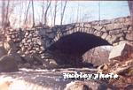
| USGS Survey stream |
|
|
| Hopkinton Sudbury River photos |
Ashland
Once notorious for the NYANZA chemical waste site, the residents of Ashland
have collectively pushed the agenda for a cleaner river bringing the EPA to town. They planned, mediated and resolved
the issues brought by NYANZA. Ashland has many environmental groups promoting a cleaner river and environment and ensuring
that the future Ashland will continue to lead the way into being an environmentally friendly community.
| Ashland Earth Day 2004 |
|
|
| Ashland Sudbury River photos |
Framingham
Much of the Sudbury River in Framingham has been inter-laced with the
MWRA reservoir system and channeled under such roads as the MA Pike and Route 9. But, there are plenty of beautiful
free-flowing river stretches that provide canoeing and fishing along it's banks still in Framingham. The start of the
designated Wild and Scenic River starts in Framingham at the Danforth Street Bridge.
| Stearns Reservoir |
|
|
| Framingham Sudbury River photos |
Wayland
The Sudbury runs lazily through Wayland. It has broad meadows that
in earlier times were hayed by farmers. After the Talbot dam was built in Billerica the river water rose eliminating these
hayfields.
| February 2006 |
|
|
| Wayland Sudbury River photos |
Sudbury
Like the Town of Wayland, early farmers used to hay the broad meadows
along the river. Native Americans used to fish near Weir Hill. Today you would find the headquarters for the U.S. Fish
and Wildlife refuge Great Meadows National Wildlife refuge here.
| February 2006 |
|
|
| Sudbury Sudbury River photos |
Lincoln
The broad meadows continue to be found along the banks. Concord and Lincoln
share Fairhaven Bay on the Sudbury River. This is a large lake like part of the river running for about a half mile and bounded
by Fairhaven hill to the south.
| February 2006 |
|
|
| Rte 117 Lincoln |
Concord
The Sudbury is slowly winding down to join with the Assabet River at
Egg Rock to form the historic Concord river.
| At Egg Rock the Concord River is formed |
|
|
| by the Sudbury on left & Assabet to right |
|